“When was that taken?”
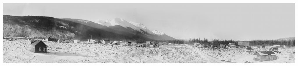
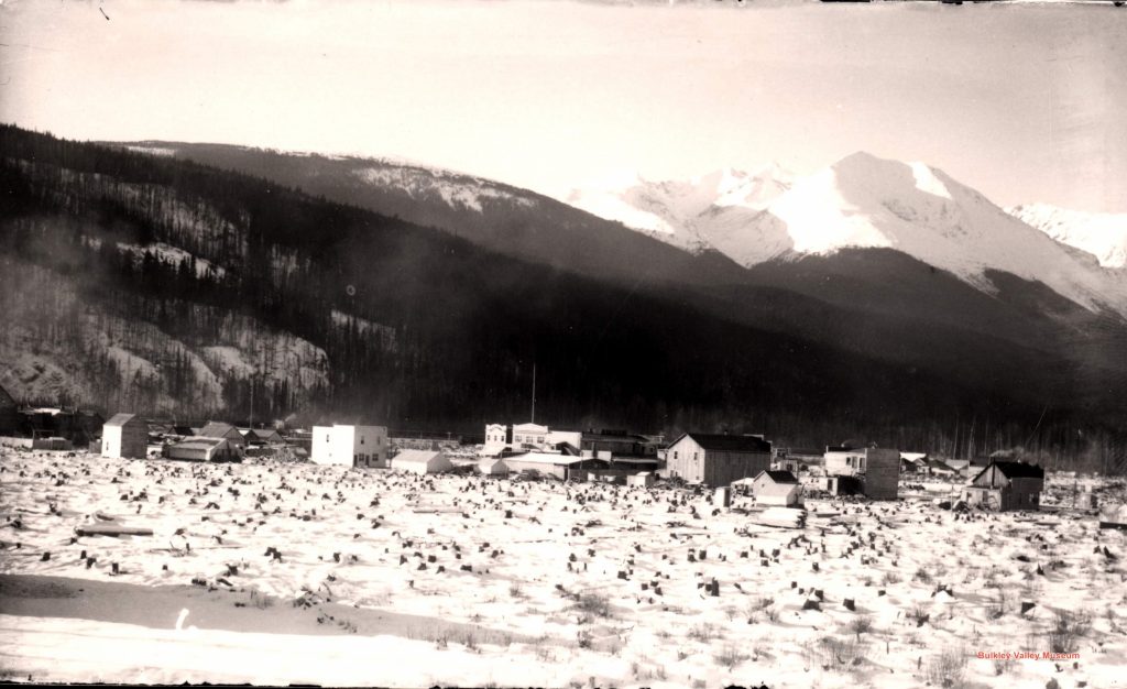
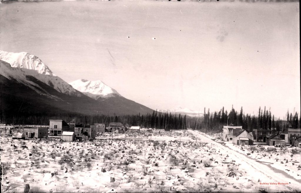
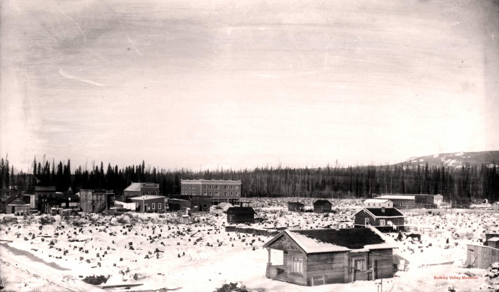
If you’ve been in the Old Church, or the office of the Bulkley Valley Museum, you’ve seen it: a beautiful panoramic view of Smithers in its earliest days. Second Avenue runs up the centre of the image, with the snow-covered Hudson Bay Mountain behind. Stumps cover the ground, and the St. James Anglican Church (now known as the Old Church) is in the foreground to the left. We have been asked the same question many times: “What year is that photograph from?” After being asked this question again recently, we decided it was time to figure out exactly when this picture was taken.
Dating photographs is not easy. We can make educated guesses based on things present in the photos, including cars, people’s clothing, businesses, and landmarks. Sometimes we are lucky enough to be looking at photos of a specific event like a parade, in which case we can date the photos very specifically. But usually we are left with an approximate date or a date range. Thousands of photographs in our archives are dated this way and their records state things like “circa 1920s” – circa being a way to say ‘approximately’.
With photos of early Smithers we are sometimes able date them a bit more specifically, depending on whether it is before or after the construction of two Smithers’ landmarks: the railway station and the Central Park Building. Until 1918 Smithers was served by a temporary wooden station that was slightly offset from the end of Main Street. Over several months between late 1918 and early 1919 the Grand Trunk Pacific Railway built the station that still sits at the end of our Main Street today. If we see the station, we can date our photograph to after 1918. Constructed in 1925, the Central Park Building is another useful landmark. If we see the building in the photo, we know it was taken after 1925.
Following the Clues
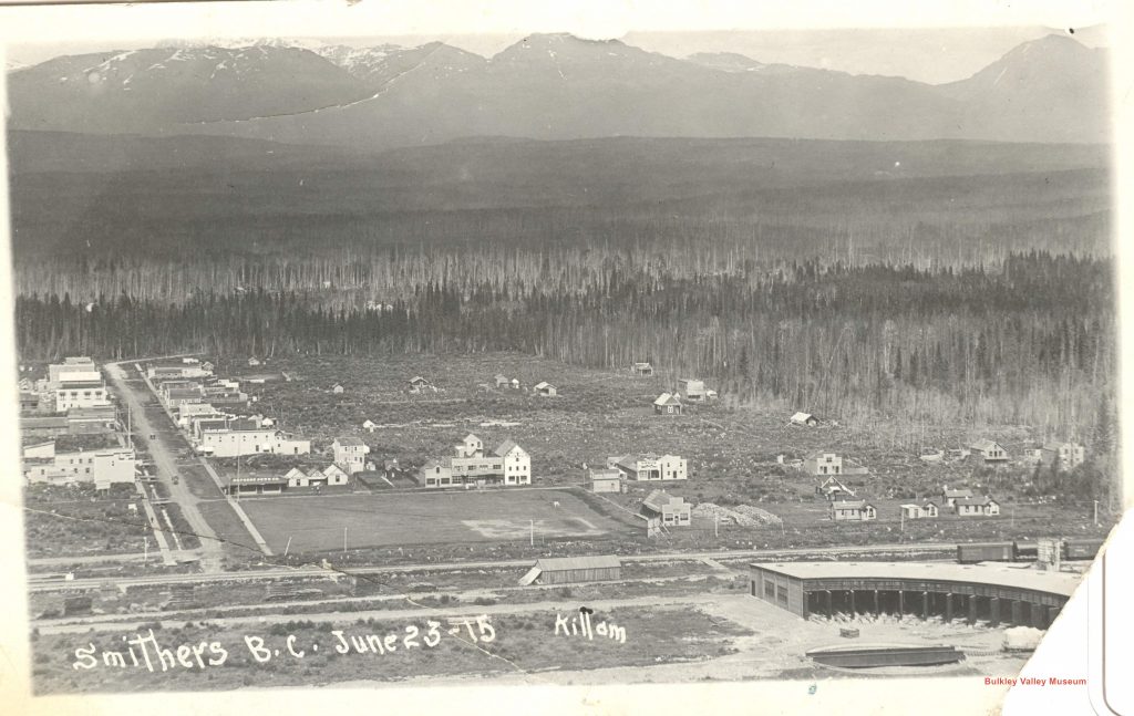
Sometimes the photographer (if known) can give us a clue. In this case, we know that the panoramic image is actually a compilation of four glass plate negatives taken by photographer Gilbert Clarke Killam.
We know that Killam lived in Smithers from 1913 to 1917, working as an architect, and serving as a member of the Smithers Citizen’s Association. He left Smithers in 1917 and returned to Vancouver, later enlisting in the Canadian Expeditionary Force. Armed with that information, we can safely date our photo to circa 1913-1917.
Getting Specific
Thanks to Mr. Killams’ productivity as a photographer (we have over 200 photographs attributed to him in our collection) and his wonderful tendency to label and date his photographs, we felt we could narrow down the date range of 1913-1917 to something much more precise. To do so, we started looking at other landmarks in the photos that make up the panorama.
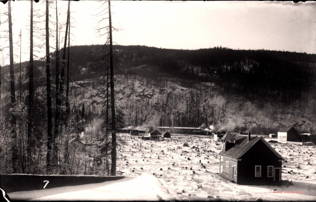
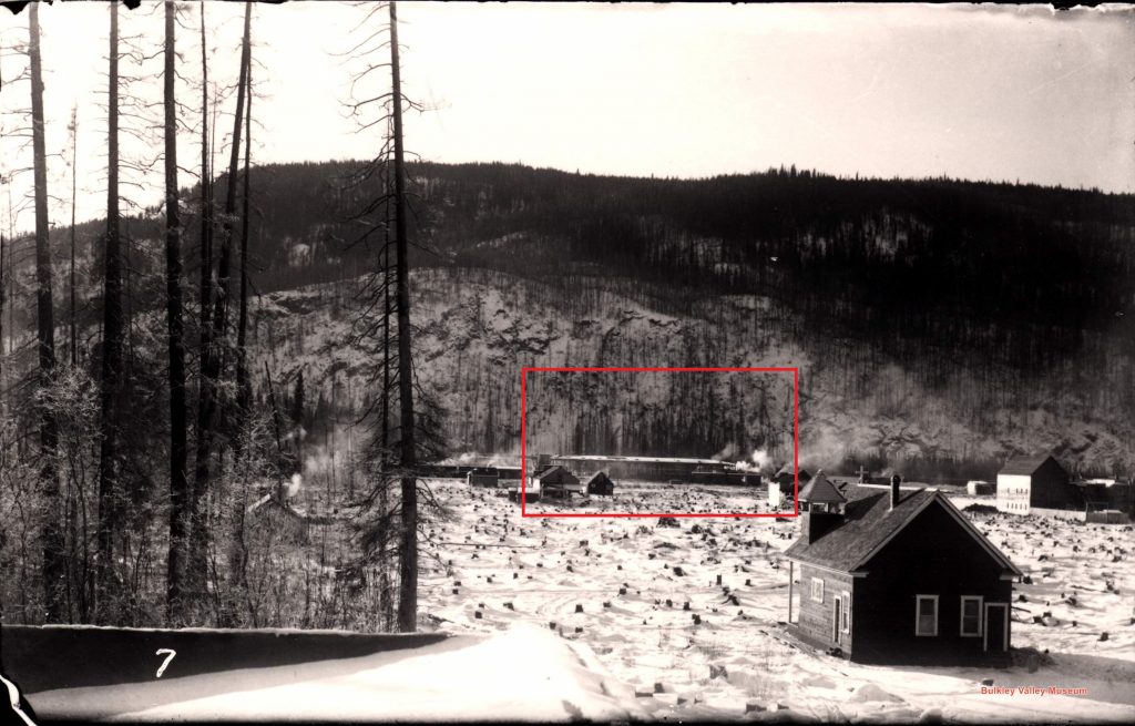
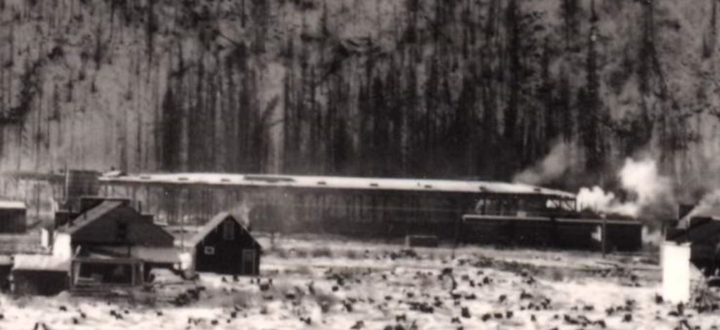
While harder to see in the compiled panorama, the original image that makes up the leftmost portion of the panorama shows the Smithers roundhouse in the background.
The roundhouse was a significant feature of the Smithers rail yard. Founded in 1913 by the Grand Trunk Pacific Railway, Smithers was the railway’s divisional point between Prince George and Prince Rupert. At the time, steam engines could usually only travel forwards, and railway companies constructed roundhouses with turntables to turn the train engines around, service them, and store them. After the switch to diesel engines in the 1940s and 1950s, roundhouses and turntables became obsolete and many were demolished. The roundhouse in Smithers was demolished in 1959.
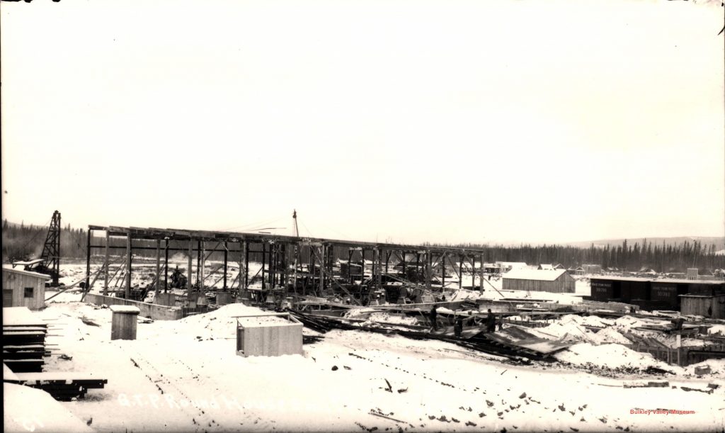
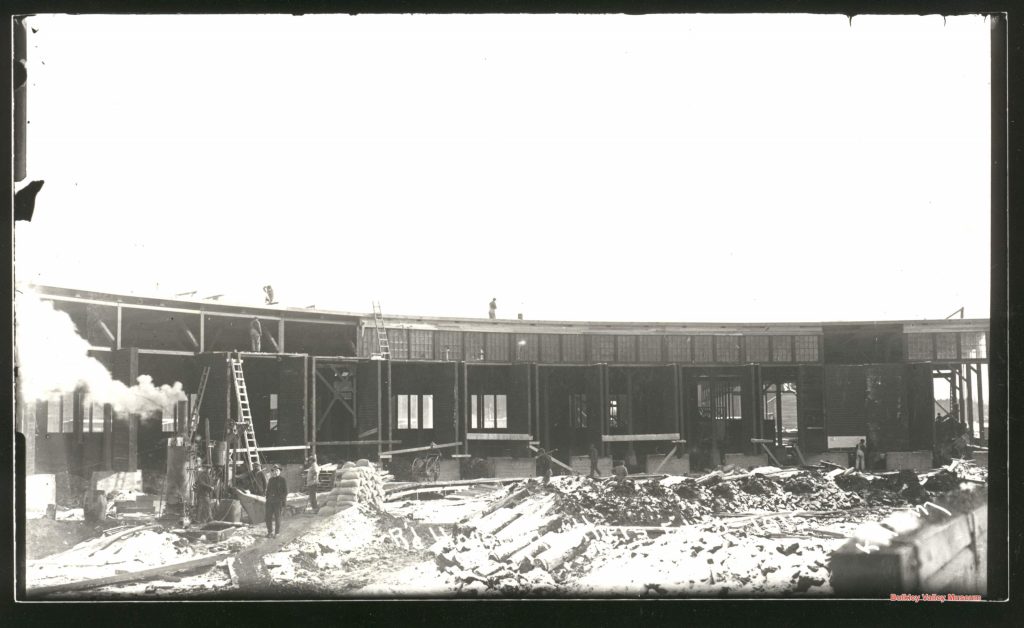
Two other Killam images in our collection detail the construction of the roundhouse. P1370 shows construction beginning in January 1915, and P4573 shows that construction was complete by June of that year.
When we closely examine the digital copy of P1384 using a zoom tool, we can see that the roundhouse is not yet fully constructed. It appears to be wood framing without walls. This, combined with the snow on the ground, allows us to date the photo to circa January-April 1915.
But we aren’t done yet! Amazingly, we were able to even more closely date this photo to sometime between January 8, 1915 (the date inscribed on P1370) and February 9th 1915. The February date is inscribed on P0633, which shows the roundhouse’s walls being put in place.
And so there we have it! Based on the state of construction of the roundhouse, the Smithers panorama can be given a very specific date of January – February 1915. Another history mystery solved, thanks to a little sleuthing, and the great work by photographer Gilbert Clarke Killam over 100 years ago.
Want your own copy of the panorama? Drop by the Museum’s gift shop and pick up a print copy for $15 or a digital copy for $10.